 Peekwick
Angel Island, the Island in the Middle of the Bay
San Francisco · Parks, beaches and animals · about 5 h
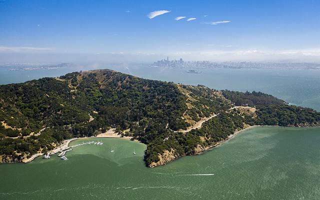
An Island in the Bay
Angel Island covers about three hundred hectares in the middle of San Francisco Bay. A narrow channel, Raccoon Strait, separates it from the town of Tiburon. It was connected to the mainland until about ten thousand years ago. The rise of the ocean at the end of the last ice age cut it off from the Marin hills. The Coast Miwok had been coming here to fish and hunt for about two thousand years. In 1775, the Spanish lieutenant Juan Manuel de Ayala sailed his ship, the San Carlos, into the bay. With his pilot José de Cañizares, he drew up one of the first maps of the bay. They dropped anchor in the cove that is now called Ayala Cove, and named the island Isla de los Ángeles, the Island of the Angels. Its highest point, Mount Livermore, rises two hundred forty meters.
In the app, this story goes on for 7 parts, to read or listen to, with one voice for grown-ups and another for kids.
A Spanish Lieutenant
His name was Juan Manuel de Ayala, and he was a lieutenant in the Spanish navy. In 1775, he sailed his ship, the San Carlos, into San Francisco Bay. With his pilot, he drew one of the first maps of the bay. In front of an island, they dropped anchor in a little cove. They called the island Isla de los Ángeles, which means the Island of the Angels. Today, the cove is named Ayala Cove, and that is where you arrive by ferry.
In the app, this story goes on for 7 parts, to read or listen to, with one voice for grown-ups and another for kids.

The full stories, the audio, the offline map and the challenges for kids.