 Peekwick
Twin Peaks
San Francisco · Mission, Castro and Twin Peaks · Parks, beaches and animals · 45 min
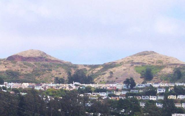
Two Hills in the Center
Twin Peaks are two neighboring hills almost at the geographic center of San Francisco. They rise to about two hundred eighty meters. Only nearby Mount Davidson tops them, by a tiny margin: it is the city's highest natural point. The two summits are called Eureka, to the north, and Noe, to the south, and about two hundred meters separate them. These hills partly block the fog. In summer, mist pushed by the Pacific Ocean hits their west slope, often cold and windy. The east slope gets more sun, and the city's eastern neighborhoods are partly sheltered. That is why it can be gray and freezing at the top when the weather is milder lower down. The soil is thin and sandy, so it is fragile. Trail work is meant to limit erosion on the slopes. It can even snow: on February 5, 1976, several centimeters of snow fell on Twin Peaks.
In the app, this story goes on for 7 parts, to read or listen to, with one voice for grown-ups and another for kids.
The Wall That Stops the Fog
Turn into the wind and close your eyes a little. Do you feel how it pushes? You are on Twin Peaks, two hills that rise almost in the middle of San Francisco. When fog comes in from the ocean, it throws itself against the west side of the hills. There, it is cold, gray, and windy. On the other side, to the east, it is often milder. So the hills act like a big wall that holds back some of the fog. That's why you take a jacket, even when it's nice down below. It has even snowed here: on February 5, 1976, several centimeters of snow fell on the hill! And under the two summits, a streetcar tunnel more than three kilometers long links the Castro to West Portal. It opened in 1918.
In the app, this story goes on for 7 parts, to read or listen to, with one voice for grown-ups and another for kids.

The full stories, the audio, the offline map and the challenges for kids.