 Peekwick
Paulista Avenue
São Paulo · Paulista Avenue · Neighborhoods, markets, and views · about 2 h
A Ridge Before It Was an Avenue
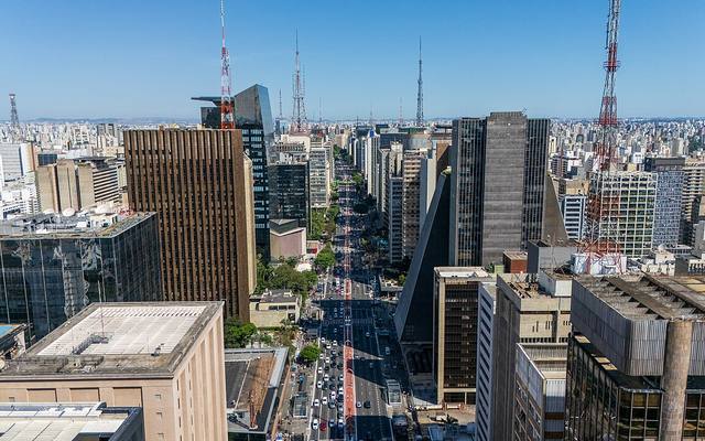
Before it was an avenue, Paulista was a ridge. It follows the top of a long hill, at an altitude of about eight hundred twenty meters. This ridge divides the waters of two rivers: the Tietê to the north and the Pinheiros to the south. The early settlers called this landform the Alto do Caaguaçu. It is a name of Tupi origin that means "the great forest." In the nineteenth century, it was only a passage area, which herds crossed on their way to the slaughterhouse. The idea of creating a district of fine homes here came from Joaquim Eugênio de Lima, an entrepreneur and journalist born in Montevideo in 1845. With partners, he bought land on the ridge. The avenue was inaugurated on December 8, 1891, with a streetcar line. Today it is about two kilometers eight hundred meters long.
In the app, this story goes on for 7 parts, to read or listen to, with one voice for grown-ups and another for kids.
Two Rivers, One Ridge
Did you know that a raindrop falling on Paulista Avenue can end up in two different rivers? It all depends on which way it rolls. The avenue is built at the very top of a long hill, like the ridge of a roof. On one side, the water runs down toward the Tietê. On the other, it flows toward the Pinheiros. Long ago, this summit had a Tupi name, Caaguaçu, which means "the great forest." Today, in place of trees, you see towers of glass and concrete.
In the app, this story goes on for 7 parts, to read or listen to, with one voice for grown-ups and another for kids.

The full stories, the audio, the offline map and the challenges for kids.